The device was launched from Baikonur at the end of March
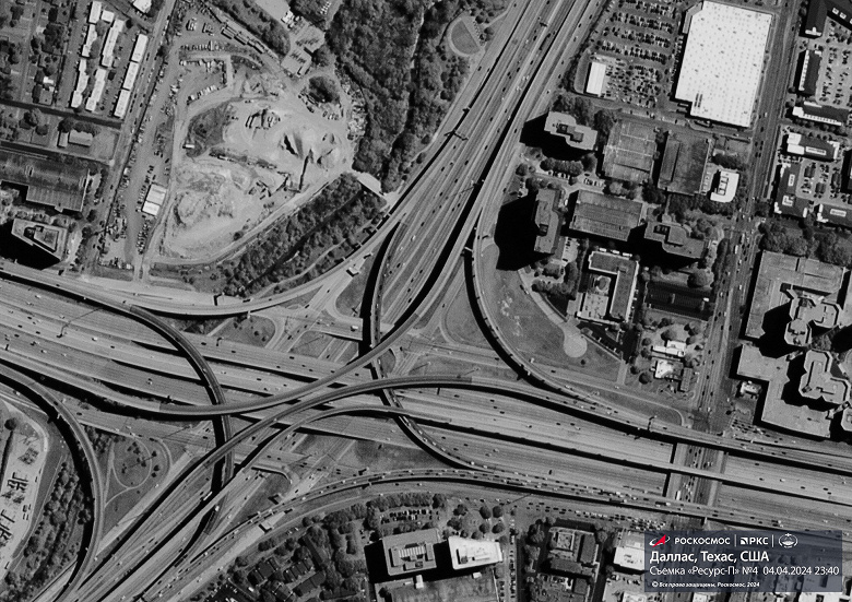
Earth remote sensing spacecraft «Resurs-P» No. 4, which went into orbit last week, sent back the first images. The first survey was carried out using high-resolution optical-electronic equipment «Geoton-L1» with a system for receiving and converting information «Sangur-1U». In the image published by Roscosmos you can see a large road junction in Dallas, USA.
Equipment of the satellite «Resurs-P» No. 4 photographs the earth and water surfaces in panchromatic and multispectral channels; it allows for surveying with a spatial resolution of 70 cm and a swath of up to 38 km. Panchromatic images are grayscale images that typically have high spatial resolution and are used to reveal details and textures in an area. Multispectral photography, unlike conventional color photography, which has only three channels (red, green and blue), can use several dozen channels.
Data received by Resurs-P satellites is used to study natural resources, monitor pollution and environmental degradation, monitor emergency areas, create and update maps, etc. Devices of the «Resurs-P» series are distinguished by ultra-high spatial resolution — less than a meter per pixel. The satellites also include equipment to improve the accuracy and speed of data processing and have stereoscopic imaging capabilities to create three-dimensional models.

